
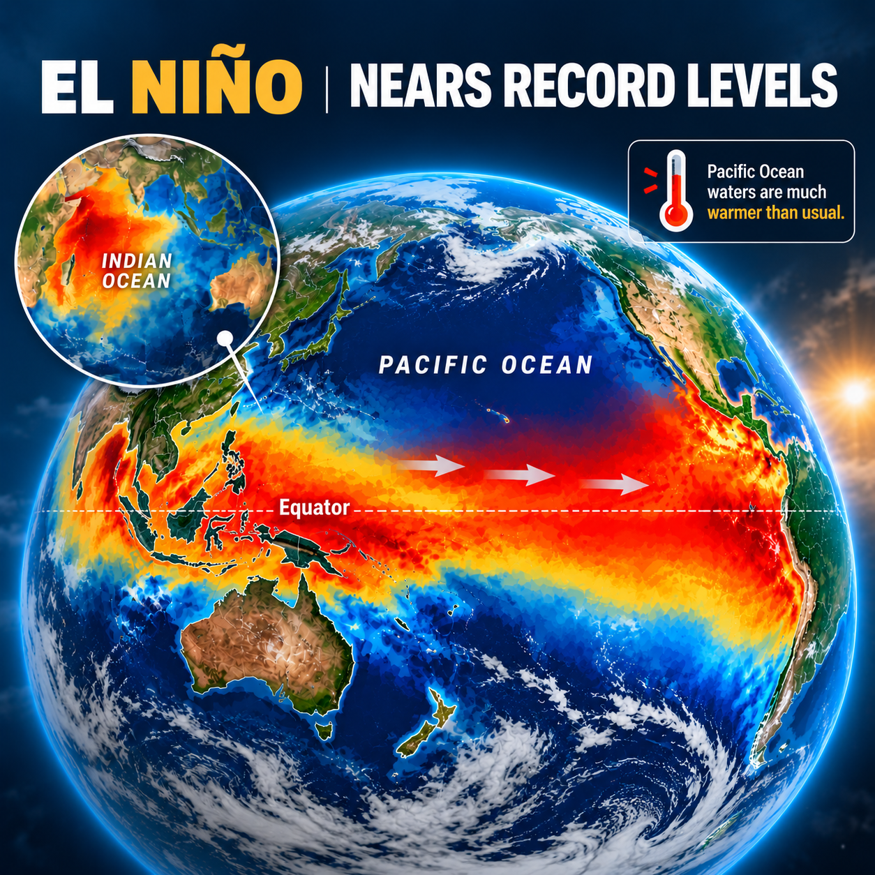
The El Niño climate pattern is strengthening, with tropical Pacific Ocean temperatures continuing to rise toward levels close to historical records, according to the report featured in the uploaded newspaper clipping.
The development is being closely watched because El Niño is associated with significant changes in atmospheric circulation, rainfall patterns, temperatures and weather conditions across different parts of the world.
The latest figures highlighted in the report indicate that the Niño 3.4 index reached +2.72°C for the week ending September 27, 2026, placing it among the highest values recorded in the historical dataset.
What Is El Niño?
El Niño is a climate phenomenon associated with unusually warm sea-surface temperatures in the central and eastern tropical Pacific Ocean.
It is part of the broader El Niño-Southern Oscillation (ENSO) climate system. Changes in Pacific Ocean temperatures can influence atmospheric circulation and weather patterns far beyond the Pacific region.
Because of this global connection, a strong El Niño can become important for agriculture, rainfall, temperatures, fisheries and seasonal weather patterns.
Niño 3.4 Index Reaches Very High Levels
One of the key indicators used to monitor El Niño is the Niño 3.4 index, which measures sea-surface temperature anomalies in a specific region of the tropical Pacific.
According to the newspaper report, the Niño 3.4 value for the week ending September 27, 2026, was +2.72°C.
The report notes that this was the second-highest weekly value on record, behind the +2.76°C recorded during the week ending November 22, 2015.
This places the current warming episode extremely close to the highest value mentioned in the report.
Models Predict Further Pacific Warming
Climate models cited in the report indicate that additional warming of the tropical Pacific is expected through the Southern Hemisphere spring, corresponding approximately to October and November.
Some models reportedly indicate that the Niño 3.4 index could rise above +3°C.
The report also states that relative Niño 3.4 values could exceed the warmest levels in the reliable historical record beginning in 1950.
However, model projections are forecasts rather than guaranteed outcomes, and the eventual strength and duration of the event can change as new observations become available.
El Niño Could Continue Into 2027
The report indicates that the warming is expected to continue beyond the Southern Hemisphere spring.
Models cited in the article suggest that El Niño could potentially peak in late spring or summer, approximately December through February, and continue into autumn 2027.
This means the climate pattern could remain an important factor in seasonal weather discussions over the coming months.
Indian Ocean Dipole Is Also Strengthening
The Pacific Ocean is not the only region highlighted in the report.
The Indian Ocean Dipole (IOD) is also showing positive values.
According to the report, the IOD index for the week ending September 27, 2026, was +0.76°C.
The index had remained above the positive threshold of +0.4°C for the third consecutive week.
A positive IOD can influence rainfall patterns around the Indian Ocean region, including parts of Australia, Asia and East Africa.
The report notes that a positive IOD could develop during the Southern Hemisphere spring and continue into early summer, although there remains uncertainty about the strength and duration of the event.
Strong El Niño Signals in the Atmosphere
The report also points to atmospheric signals supporting the ongoing El Niño conditions.
One of the indicators mentioned is the presence of weakened or reversed trade winds over the western Pacific.
Trade winds normally play an important role in moving warm surface waters across the tropical Pacific. Changes in these winds can contribute to the redistribution of warm ocean water and influence the development of El Niño.
The combination of ocean temperature anomalies and atmospheric changes is therefore important when assessing the evolution of the climate pattern.
Global Ocean Temperatures Remain Extremely Warm
Another important observation highlighted in the article is the unusually high level of global sea-surface temperatures.
The report states that global SSTs remained at record levels, with temperatures across the 60°S–60°N region reaching their highest level on record for any month since 1900.
The reported average was 1.04°C above the 1961–1990 average.
This broader ocean warming provides important context for understanding the current climate conditions.
Warmer Waters Around Australia
The report also highlights warmer-than-average waters around parts of Australia.
Sea-surface temperatures around Australia’s west, south and southeast were reported to be up to 3°C above average.
Ocean temperatures can affect marine ecosystems, weather systems and atmospheric processes, making these regional anomalies important for climate monitoring.
What Could a Strong El Niño Mean?
A strong El Niño can influence weather patterns differently from one region to another.
Potential effects can include changes in:
- 🌧️ Rainfall patterns
- 🌡️ Temperature patterns
- 🌾 Agricultural conditions
- 🌊 Ocean ecosystems
- 🐟 Fisheries
- 🌪️ Seasonal weather patterns
- 💧 Water availability
- 🌍 Global climate patterns
The actual impact depends on location, season and the interaction of El Niño with other climate factors such as the Indian Ocean Dipole.
It is therefore important to avoid assuming that El Niño will produce the same weather conditions everywhere.
El Niño and the Indian Ocean Dipole: Why Both Matter
The simultaneous development of a strong El Niño and a positive Indian Ocean Dipole is particularly important for climate monitoring because both climate patterns can influence atmospheric circulation and rainfall.
Their combined effects can vary considerably depending on the region and time of year.
For countries such as India and Australia, monitoring both the Pacific Ocean and Indian Ocean can provide useful context for understanding seasonal climate conditions.
However, regional weather outcomes cannot be determined from a single climate indicator alone.
Why Ocean Temperatures Matter
The oceans store enormous amounts of heat and play a major role in Earth’s climate system.
When ocean temperatures become unusually warm, they can influence:
- Atmospheric circulation
- Moisture availability
- Rainfall
- Storm development
- Marine ecosystems
- Seasonal temperature patterns
The current combination of very warm Pacific waters and elevated global sea-surface temperatures makes ongoing ocean monitoring especially important.
What to Watch in the Coming Months
As the El Niño event develops, several indicators will be important to monitor:
1. Niño 3.4 Temperatures
Future readings will show whether Pacific warming continues toward or beyond the levels discussed in the report.
2. Trade Winds
Changes in Pacific trade winds can provide important clues about the strength and persistence of El Niño.
3. Indian Ocean Dipole
The development and persistence of positive IOD conditions may influence regional rainfall patterns.
4. Global Sea-Surface Temperatures
Continued monitoring of global ocean temperatures will help put the Pacific warming into a broader climate context.
5. Seasonal Weather Forecasts
Updated seasonal forecasts will provide more detailed information about possible regional impacts as the event develops.
Conclusion
The latest information featured in the newspaper report points to a very strong El Niño developing in the tropical Pacific, with the Niño 3.4 index reaching +2.72°C for the week ending September 27, 2026.
With climate models indicating the possibility of further warming, alongside a strengthening positive Indian Ocean Dipole, the coming months will be important for climate monitoring.
At the same time, the reported record-high global sea-surface temperatures demonstrate that the current El Niño is occurring against a backdrop of exceptionally warm oceans.
Understanding these climate indicators can help governments, farmers, businesses, researchers and communities better prepare for potential changes in seasonal weather conditions.